Editor’s Note: Though this trip took place on August 17, 2016, and the post is time stamped to reflect this date, the actual writing of this post happened on August 23.
I like calling my hikes "expeditions" because it makes me feel awesome. But, I am going to reserve this word for trips that summit mountains so that it maintains it's special feel. Mount Willard (elev. 2,865 ft) may barely qualify as a mountain, but nonetheless, I'll call this an expedition.
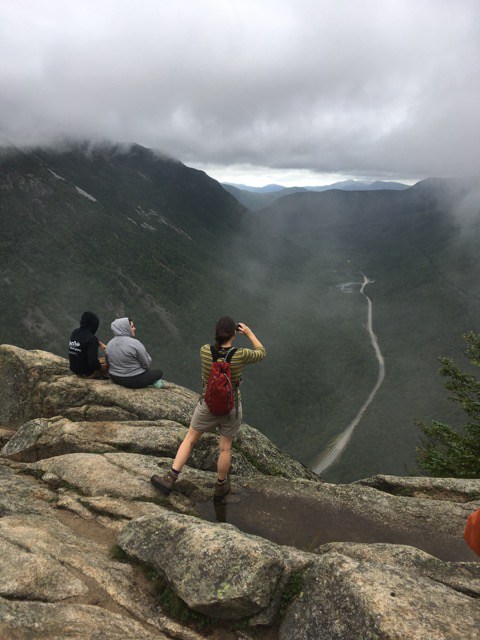
On the other hand, there is a funny thing about the hike up Mount Willard - the trail ends just before the actual peak of the mountain. So, technically, we didn't quite reach the summit. That said, the cliff-top area where people gather after their hike up provides spectacular views of Crawford Notch. Since the rock face is exposed, the view are unobstructed, but so are the winds. Though it was a warm day, the top was cold and cloudy, with lots of fog - and fierce, gusty winds that blew without ceasing. In the cover of the forest and thus for most of the trail, the trees provided protection from the winds.
First, here is a map of the route we took:
There is a nice parking lot across 302 from Saco Lake (a handy map) just south of the AMC Highland Center and next to the Crawford Notch Station where the Conway Scenic Railway stops on it's Notch Train excursions. We witnessed the train when we retuned from our hike. There is also a small shop and restrooms - both of which are handy.
The day was warm at our Vermont HQ, but even at the base of Willard near Crawford Notch Station the temps had dropped considerably. We were a bit concerned at the onset that we might be too cold at the top, but things turned out ok as we worked up a healthy sweat on the hike.
The trail up Willard is an out-and-back and doesn't connect to any other trails. It does, however, start off with the Avalon trail. After a short stint, the Willard branches to the left off of Avalon. The Avalon trail continues southwest and eventually connects with the Appalachian Trail. The Willard hike is fairly easy, though it does climb some - we had about 1,000 feet of elevation gain in 1.5 miles up. The total round trip was 3.4 miles and took us just about 2 hours, with a 20 minute break on the top to enjoy lunch and the view.
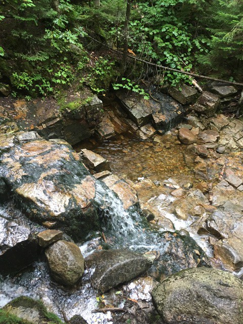
The trail follows a stream most of the way, and this provides opportunities for waterfalls, cascades and pools. Plus, the pleasant rush of the running waters provides a great soundtrack to the hike.
This hike is popular, presumably because it isn't too hard and provides a fantastic view of the Crawford Notch, as already mentioned.
As you can see from the photos, we got a pretty cloudy day - and though the fog was thick, we still managed some great views. The wind was more bothersome, and we didn't linger long. Just long enough to soak it in and eat some lunch. The cliffs are quite dramatic, and vertigo can set in if, like me, you have an aversion to heights. I just kept a safe distance from the edge!