Editor’s Note: Though this trip took place on August 19, 2016, and the post is time stamped to reflect this date, the actual writing of this post happened on August 23.
So, after our success on Mount Willard (read all about it here), we decided to up the ante and try one of Vermont's genuine 4,000 footers - Camels Hump (height 4,083 ft.). You might think I mean "Camel's Hump", but oddly, the official name as recorded by the U. S. Board on Geographic Names omits the apostrophe, so Camels Hump it is! Locals of course usually include the apostrophe, suggesting that the hump is owned by a camel, but I don't care! I just hiked the sucker!
We knew this one was going to be a bit more demanding. However, after reading a number of online trip reports, it sounded like we could handle it. We discovered on our journey that the hike was much harder than we expected, even after reading the reports. It isn't impossible, by any means, but it does pose a challenge to your average hiker, with significant sections requiring four-legged scrambling and a decent elevation climb.
We planned the route above - starting off on Burrows Trail but quickly taking the Connector over to Forest City Trail. The FCT ends up at the Long Trail, south of the peak, and we took the Long Trail on up to the top. This was by far the hardest section of trail we hiked, and where most of the scrambling occurred. Finally, after some time on the summit, we descended back following the Burrows Trail back to where we parked.
The parking spot is located at the end of Camels Hump road. However, be careful!! We learned the hard way that there is more than one road named Camels Hump. So make sure you are headed to the right place. The hike along the Forest City Trail follows a stream for bit:
After the FCT joins up with the Long Trail, things start to get a bit more challenging. Scrambling up rocks on all four is not uncommon.
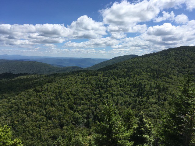
A bit after some of those tough scrambles up the Long Trail you come to Wind Gap, which provides a great view through a clearing.
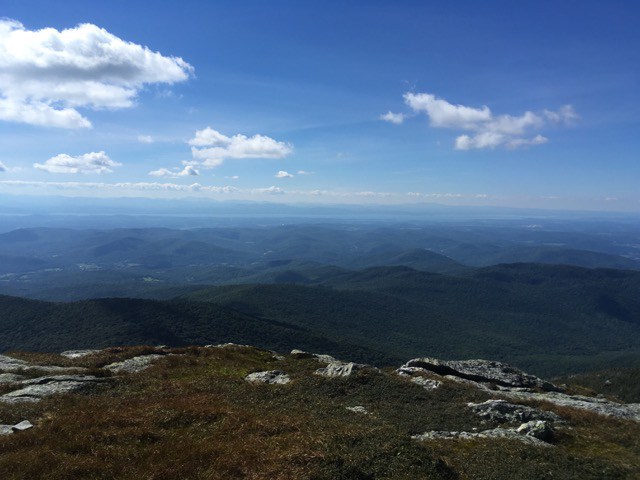
Some more scrambling and rock climbing - all challenging for us, but doable - resulted in a joyful rest on the summit. One thing I will say about Camels Hump is that the summit is quite nice - wide, open with great views in all directions. You can see Lake Champlain stretched across the land. You can see Mount Mansfield and even Mount Washington. Spectacular views and lots of room to share the space with others. We caught a perfect day and the temperature was really nice and it wasn't too windy. Just spectacular.
We had eaten lunch just before we reached the summit. Still the summit is a great place to dine. The alpine region above the tree line is host to a number of fragile plant species and there are markers and signs warning you to not damage the foliage. Generally, that was not a problem as we just stayed aware of where we were stepping. We chilled out, absorbed the view, chatted with a few other climbers, and then began our descent, first on the Long Trail over Camels Hump and then on to Burrows Trail for the return. Burrows is a much easier trail than the FCT, but it lacks the impressive views. It's main perk is that it allows you to make your trip a loop, instead of an out-and-back, and it is a faster return. If you just wanted to get up Camels Hump and get back, it would be faster and easier to just go up Burrows and back Burrows. But that's too boring for us!
The hike took us 5 hours and 22 minutes and we covered 5.6 miles. Whew!! About 2500 feet of elevation gain and loss. Double whew! Our 5 hour time included quite a bit of time on the summit and a few solid breaks for rest and lunch along the way. A great day! But we were wiped - I mean really wiped!! So a few days of rest were in our future.
Camels Hump is a challenging hike, but it provides great views and a great sense of accomplishment.

