Yesterday provided a perfect early-summer day to go look at a waterfall. This time of year, the rivers and lakes are full, so waterfalls have ample fuel. We decided on Arethusa Falls, just south of the AMC facility in the White Mountains. Nearby Frankenstein Cliff offered another opportunity for great views.
It was a warm day, slightly overcast. But the sun poked through often and we sweated a lot. The trip took us about four hours, and covered just over 5 miles and about 1400 feet of elevation gain. Generally, I would classify this as a moderate hike, however there were stretches on the downhill portion after Frankenstein Cliff that many (myself included) would find challenging. They are short portions, however, and we managed them without too much difficulty.
Ample parking by the trail head made us quickly aware that this is a popular destination. The hike from the parking spot to the falls themselves was very popular and we passed many hikers heading back down as we were heading up. The trail during this section was easy to follow. The only challenges were the climb, the many roots, and the occasional mud. In rainy weather, this trail would be much tougher.
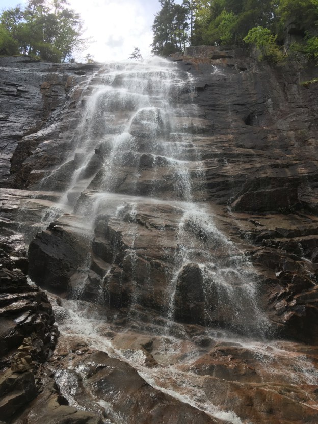
A short, downhill spur leads to the falls themselves. The air gets much cooler as you approach, and you can feel the gentle spray as the water cascades down. The falls were much larger than I expected.
After a few moments at the falls and a snack, we headed back up the spur trail and then turned off toward Frankenstein Cliff. This trail had far fewer hikers on it - we only saw a couple - and was harder to follow. Some sections follow creek beds and you have to look for the yellow blazes to make sure you are going the right way. Also, since this trail appears to be much less popular, the trail is often narrow and overgrown. Just the way we like it!
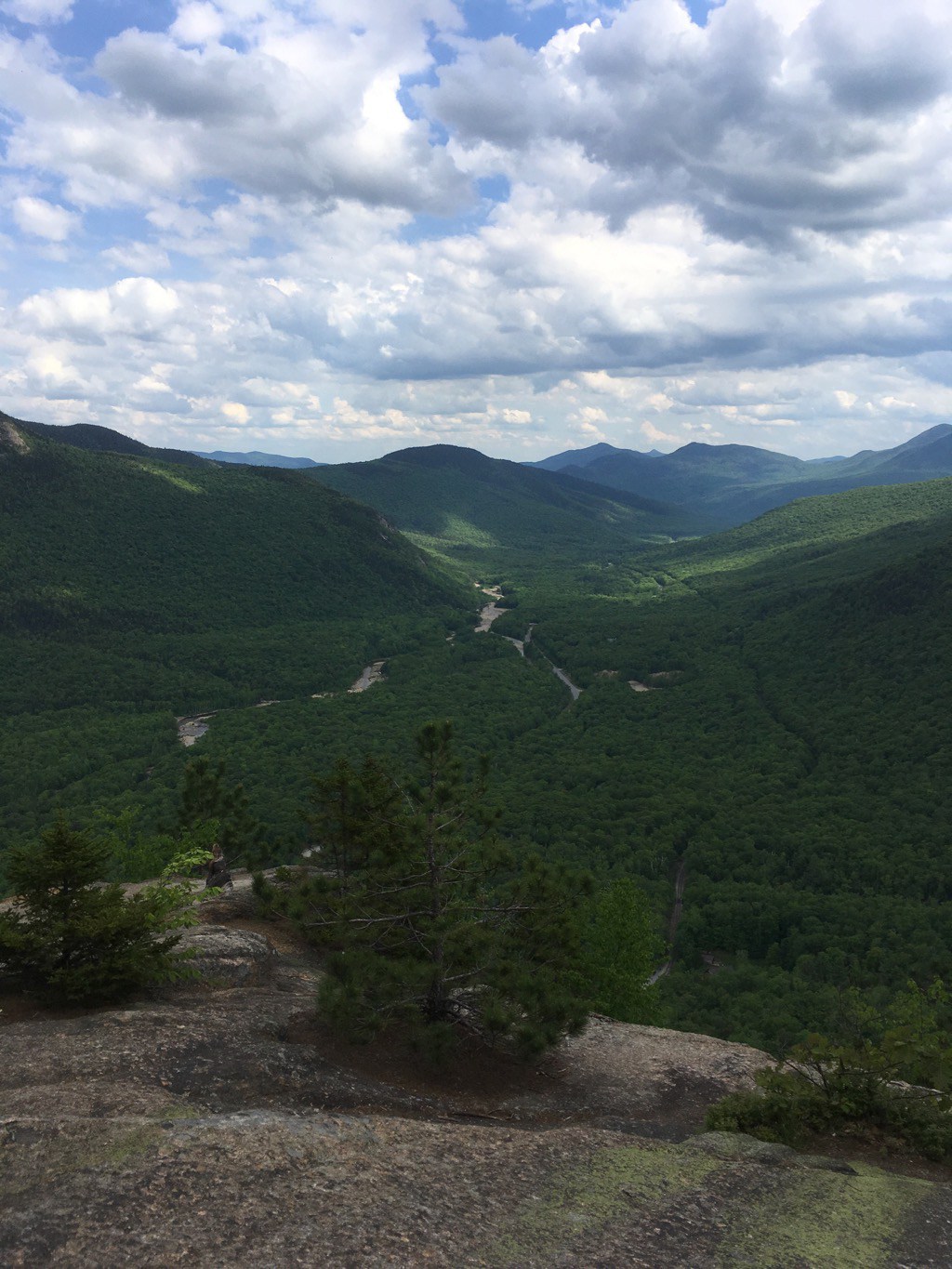
The Frankenstein tail begins with a bit more uphill, until you reach a high point that offers some views, but is mostly blocked by trees. The real view is on down from that "peak" at the Frankenstein Cliff overlook. Here, the view of the Saco River valley is spectacular, and sadly, my iPhone camera did not come close to capturing the beauty.
Heading down from here is when things start to get a bit tricky. The trail down from the cliffs makes a number of switch backs and is often narrow and muddy. As you come down, you begin to realize how dramatic those cliffs are, looking back and up.
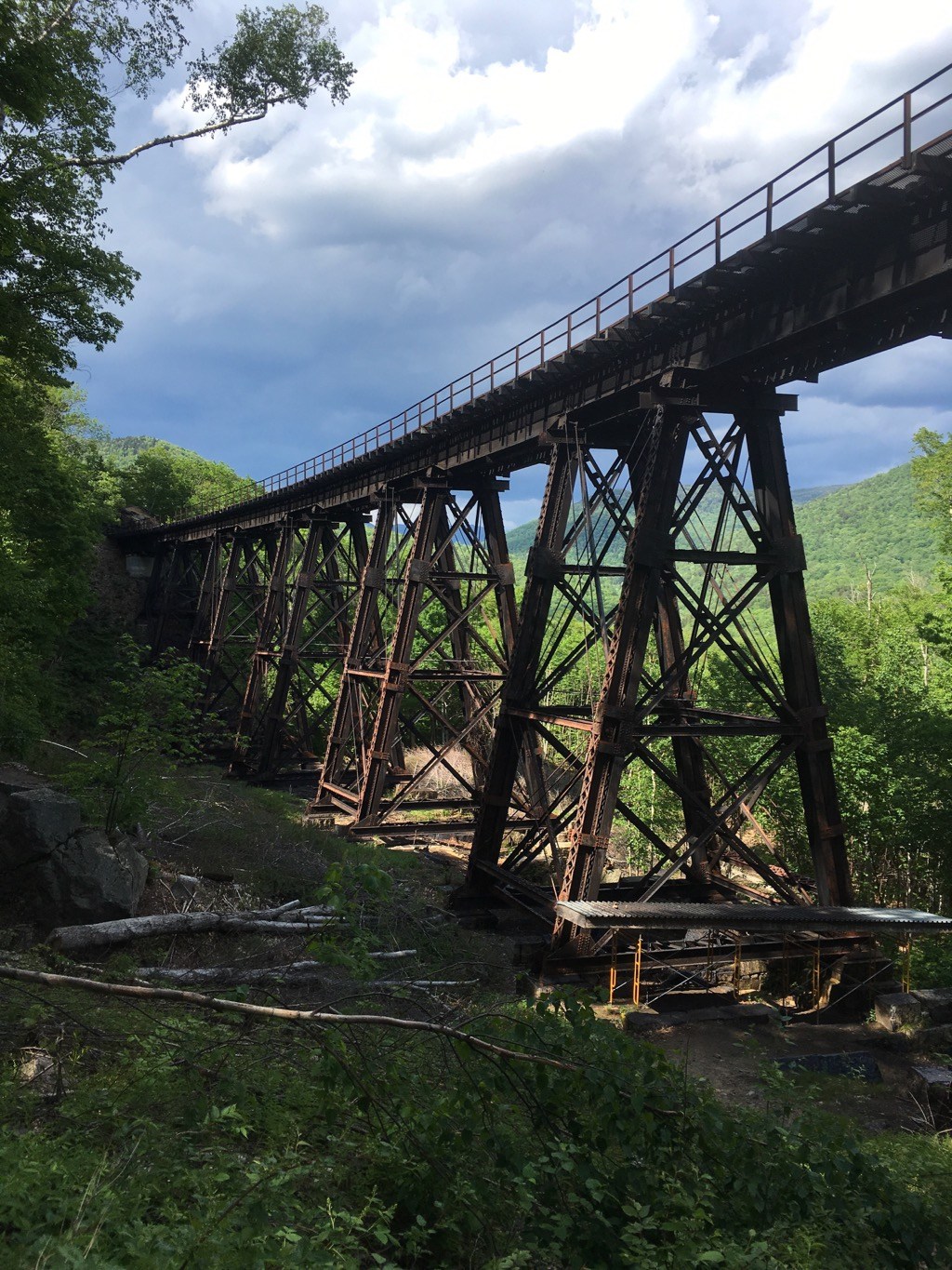
After you come down from the cliffs, you encounter the railroad, and this amazing elevated bridge. The trail continues under the bridge, which was confusing at first because my navigation software followed the train tracks themselves back to the parking lot. The AMC Guide says that walking the tracks is dangerous and prohibited, do I don't recommend it, tempting though it was. The trail actually follows basically the same route, just to the south of the tracks and presumably out of the way of trains.
And finally, here is the route we took:
All in all, this was a great, challenging hike, with New Hampshire's tallest waterfall at 200' and a great cliff view to boot. A good way to spend the afternoon.